By Dr. Laura Crawford, Assistant State Archeologist at the Nebraska State Historical Society
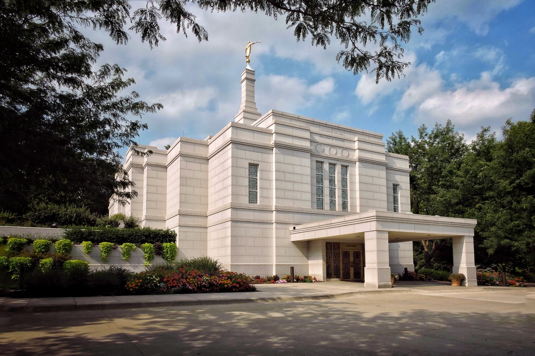
In the summer of 2024 Assistant State Archeologist Laura Crawford was contacted by Hillary Kirkham of the Church of Jesus Christ of Latter Day Saints (LDS) to conduct a Ground Penetrating Radar (GPR) survey of the Winter Quarters cemeteryin Florence, just outside of Omaha, Nebraska (Figure 2). The cemetery was to undergo renovation work, including installing more lighting and security systems (Figure 3).

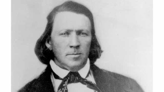
Winter Quarters was a stopping-over point for LDS members on their way to the Salt Lake Basin and was occupied from 1846-1848 under the direction of Brigham Young (Figure 4). The winter of 1846-1847 was especially grim, and at least 400 LDS members died of disease and exposure, many of whom are buried at Winter Quarters cemetery in now unmarked plots.
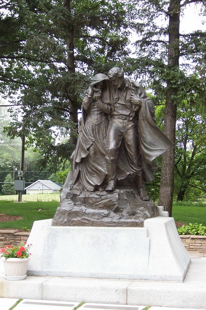
Nickel and Nickel (2022) previously conducted GPR work around the 1936 bronze monument (Figure 5) high on the cemetery’s hill, working with former State Archeologist Rob Bozell. This was necessitated by the LDS church’s efforts to remove and replace the degraded terrazzo pavement around the monument. Nickel and Nickel (2022) identified probable unmarked graves that corresponded with lines of graves suggested by four known graves in the area, and at least two more rows of probable graves (Figure 6). Nickel and Nickel (2022) report finding the tops at graves from 0.3-0.6 meters (m) below surface (bs), and known graves were still visible at 0.9-1.2 m bs after the removal of the terrazzo pavement and .5-1.0 m of soil.
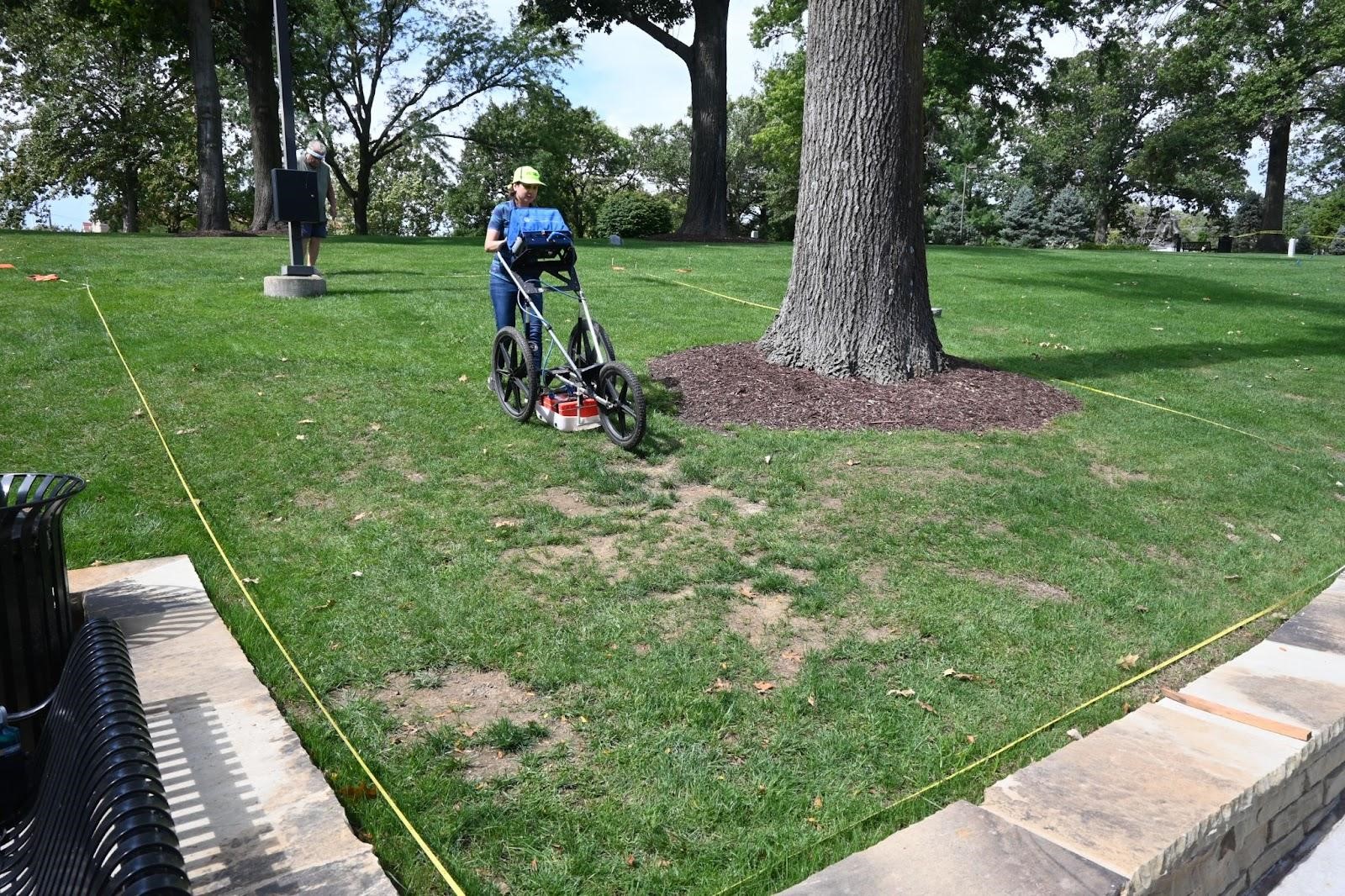
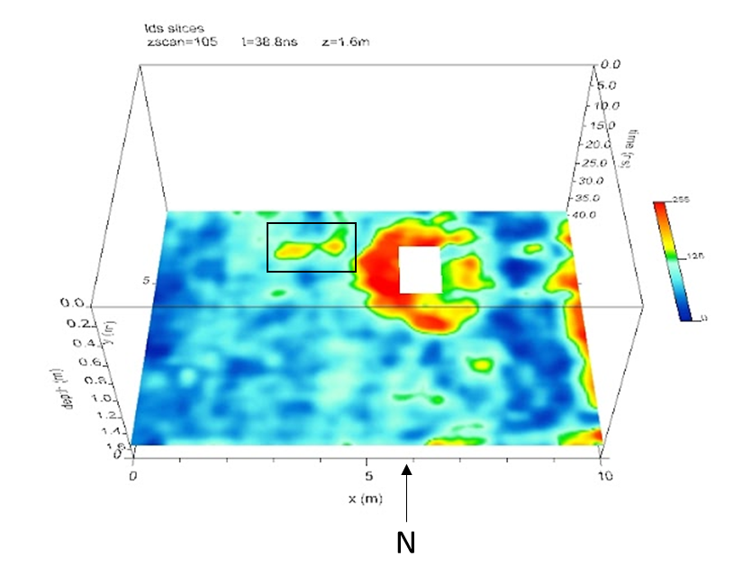
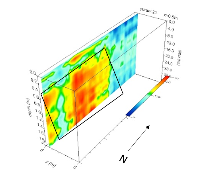
On September 17th and 18th of 2024, Assistant State Archeologist Laura Crawford, retired Midwest Archeological Center archeologist and geophysical expert Steven L. DeVore, and State Archeologist Dave Williams conducted a GPR survey at the Winter Quarters cemetery. They examined six different areas (Figure 7) surveying in both the X and Y (north and east) dimensions 25 cm transects. Transects were conducted in the unilateral direction (as opposed to the “zigzag” method) to pick up on even the smallest graves. GPR-Slice software was used in the lab to interpret the results (Figure 8).
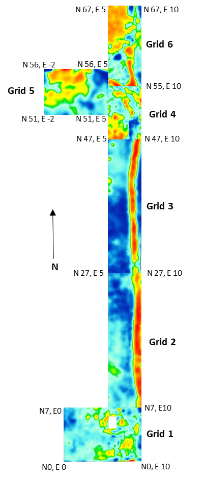
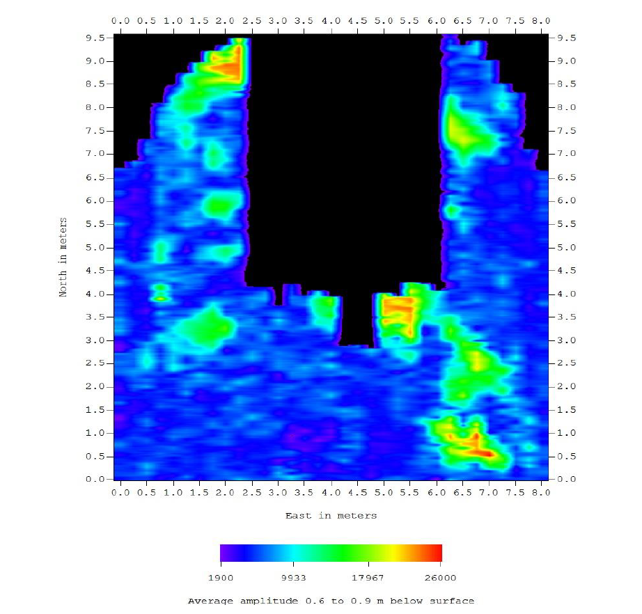
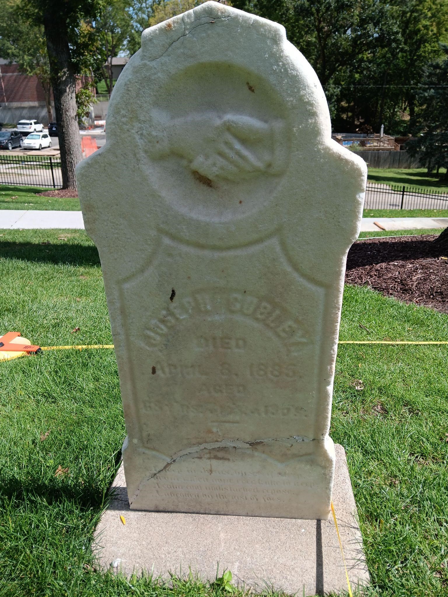
As outlined by black boxes, Laura Crawford and Steven L. DeVore identified rows of probable graves in Grid 1, Grid 2, Grid 3, Grid 4, but not Grid 5 or Grid 6. In Grid 1 they re-located the known grave of Joseph Cubley (Figure 9 and 10).
Probable unmarked graves appeared as rows of high amplitude (red and yellow) reflections in the GPR-Slice Software as outlined in black boxes (Figure 11). The GPR unit was probably not picking up signatures from caskets or coffins as these have likely long since decayed. Though perhaps not decayed, the GPR unit was also not likely picking up on signatures from skeletal remains as skeletal remains closely match the signature of the surrounding soil. Instead, the GPR unit was more likely picking up on soil disturbances resultant from the excavation and backfilling of grave shafts. The grave shafts identified by GPR begin relatively near the surface – 0.3-0.6 m bs – which was unexpected given what Nickel and Nickel (2022) found in their survey. This suggests that the depths of burials varied throughout the cemetery, perhaps due to the time of year individuals were interred – digging a grave in frozen ground is very difficult, for example. However, we cannot be sure how deeply individuals were interred since we only have signatures from the grave shafts themselves.
The LDS church is acutely interested in family history. This research, in addition to the Family Search work being done at the NSHS Archives, aids the LDS church in locating their ancestors and filling in gaps in family history. Moreover, the GPR study can help identify where unmarked graves are potentially located, making it possible to avoid disturbing resting places when conducting renovation work at the Winter Quarters cemetery. Even so, it was recommended that the LDS Church ensure monitoring takes place whenever there are ground disturbing activities at the cemetery.
References
Nickel, Robert K. and Catherine A. Nickel
2022 A Ground-Penetrating Radar Survey of Areas Surrounding the Monument at the Mormon Winter Camp Memorial, Florence, Nebraska. Report prepared for Rob Bozell of History Nebraska.
